|
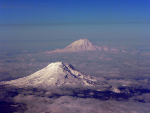
Hidden Journeys is a website dedicated to exploring the world through the air using amazing and awe-inspiring images of fascinating and beautiful areas by the Royal Geographical Society (London). Recently the story of the passage along the Cascades was illustrated on a journey between the two cities of Denver and Seattle and the Royal Geographical Society kindly got in touch to show me the work and share information about the project which I thought would be good to share as well.  (C) Aaron Schmidt. Rainier and Adams through the clouds. By clicking along the scrolling images along the top and selecting the Cascade Mountains section you get through to a page with three sections of images on the Cascades, the famous 1980 eruption of Mt St Helens and a section on Mt. Rainier (featured in an earlier blog post of mine), the towering volcano which rests above the city of Seattle like a sleeping giant. Each section gives a good overview of the region, the volcanoes and the most important features around them. A graphic in the first section demonstrates how important research and study is of Mt. St Helens, not just for its 1980 eruption, as eruptions at this volcano are typically more frequent than at other cascade volcanoes. I have included a selection of the images on this blog post (click on images to see larger versions), but to see the rest you will need to visit the site, I certainly recommend a visit! In my next post I will be talking more about the volcanics of the region and more about one of the relatively forgotten volcanoes of the region Mount Hood in addition to the importance of the volcanoes further south in the cascades which generally recieve less focus online and in the media but are equally as important and fascinating. What is Geoinformatics?
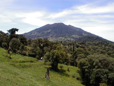
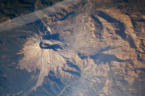
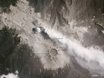
Geoinformatics (sometimes referred to as geographic information science or GIS) is a term which has been given a variety of descriptions but generally it refers to data which has been collected through techniques such as remote sensing and which are finally analysed, processed and visualised on a computer. At first glance it may seem that geoinformatics doesn’t play a large role within volcanology, however when one delves deeper, there is a huge amount of research and literature combining geoinformatics practices to solve and present volcanological problems. In the past, volcanology was purely based on written observations, however with the advancement of technology the need for processing and more sophisticated analytical techniques has led to the incorporation of geoinformatics within volcanology. Some examples of application....mapping (particularly hazard mapping), monitoring and extra-terrestrial mapping/investigation. A perfect example of Geoinformatics and volcanology is the brilliant NASA Earth Observatory website (example image below), it is through the taking of images such as these that we know about eruptions of remote volcanoes. I am sure there are many more applications of geoinformatics within volcanology out there, this was just an overview of some of the most important! If you are interested to learn more, read this summary here. On the 12th Januray a new vent opened at the Turrialba Volcano in Costa Rica.  Turrialba Volcano, taken by Eliecer Duarte (OVSICORI-UNA) (GVP) Turrialba Volcano, stands at over 3300m high and is characterised by Basaltic to Dacitic type lavas. The initial fumarolic vent formation was caused by overpressured rock which then collapsed to allow gases and what people refer to as non-juvenile or material not from fresh magma to escape. A fumarole is a vent which emits steam, gas or potentially other volcanic material at high temperatures, generally ranging from 100 to 1000 degrees celsius. The openeing of this vent was caused by the breakdown of the rock material, typically, but not exclusively, volcanoes in humid regions such as Costa Rica are more susceptible to collapse. This is caused by acidic water eroding and weakening rock, which, when the correct pressure is applied is liable to collapse. This process can be sped up by a constant degassing volcano such as Turrialba currently. I highly recommend watching this video of the area after the 12th January incident, there is also a very good summary of the event by the Costa Rican Volcanology and Seimsmology Observatory available here. The video below shows activity recorded on the 18th January as an ash and steam emission began on the volcano. With another Costa Rican volcano, Irazú, a new eruption was preceeded by the opening of several new fumarolic vents, however OVSICORI-UNA have stated they do not currently believe a new eruption is expected soon, however they do state that Turrialba is an active volcano and the situation could change quickly due to its constant degassing state.
|
Archives
July 2023
|


 RSS Feed